4/29/2011
KOREA-PORTAGAL RELATIONSHIP
FDC KOREA

stamp issued 15th April 2011
arrived 28th April 2011
thanks Park Choonjong @ Seoul Korea
4/22/2011
4/19/2011
LIEPAJA
Liepāja, historical variant: Libau, is a city in western Latvia, located on the Baltic Sea directly at 21°E, and the administrative center of Liepāja district. It is the largest city in the Kurzeme Region of Latvia, the third largest city in Latvia after Riga and Daugavpils and an important ice-free port. As of 1 January 2010, Liepāja had a population of approximately 83,000.
Liepāja is known throughout Latvia as "The city where the wind is born", possibly because of the constant sea breeze. A song of the same name (Latvian: Pilsētā, kurā piedzimst vējš ( audio (help·info)) ) was composed by Imants Kalniņš and has become the anthem of the city. The reputation of Liepāja as the windiest city in Latvia has been further endorsed as the biggest wind power plant in Latvia (33 Enercon wind turbines) was constructed nearby.
The Coat of Arms of Liepāja was adopted four days after it gained city rights on 18 March 1625.[2] These are described as: "on a silver background, the lion of Kurzeme with a divided tail, who leans upon a linden (Latvian: Liepa) tree with its forelegs." The flag of Liepāja has the coat of arms in the center, with red in the top half and green in the bottom.
RIGA
Latvia (i /ˈlætviə/; Latvian: Latvija), officially the Republic of Latvia (Latvian: Latvijas Republika), is a country in the Baltic region of Northern Europe. It is bordered to the north by Estonia (border length 343 km), to the south by Lithuania (588 km), to the east by the Russian Federation (276 km), and to the southeast by Belarus (141 km). Across the Baltic Sea to the west lies Sweden. The territory of Latvia covers 64,589 km2 (24,938 sq mi) and it has a temperate seasonal climate.
The Latvians are Baltic people culturally related to the Estonians and Lithuanians, with the Latvian language having many similarities with Lithuanian, but not with the Estonian language (a Finnic language). Today the Latvian and Lithuanian languages are the only surviving members of the Baltic languages of the Indo-European family. The modern name of Latvia is thought to originate from the ancient Latvian name Latvji, which, like the name of Lithuania, may have originated from the river named Latuva.[citation needed] The country is also the home of a large Russian minority of whom many are non-citizens.
Latvia is a unitary parliamentary republic and is divided into 118 municipalities (109 counties and 9 cities). The capital and largest city is Riga. With a population of 2.22 million Latvia is one of the least-populous members of the European Union, and its population has declined 15.1% since 1991. Latvia has been a member of the United Nations since September 17, 1991; of the European Union since May 1, 2004 and of the NATO since March 29, 2004.
Following a period of Soviet occupation after World War II, Latvia regained its independence in 1991. After years of economic stagnation in the early 1990s, Latvia posted Europe-leading GDP growth figures during the 1998–2006 period. In the global financial crisis of 2008–2010 Latvia was the hardest hit of the European Union member states, with a GDP decline of 26.54% in that period.Its per capita GDP is 49% of the EU average in 2009, making it the third poorest member-state
4/18/2011
BRASIL

BRASIL Os selos desta emissão focalizam a presença holandesa no Brasil, apresentando, o Período Nassoviano e sua nítida influência assinalada na região Nordeste, e, em particular, no estado de Pernambuco, bem como os seus reflexos perpassados por mais de três séculos, até nossos dias.Um escrivão da Fazenda Real, quando inventariou os prédios e apetrechos bélicos deixados pelos holandeses, ao se referir ao momento de governo de João Maurício de Nassau, disse ser o do Tempo da Boa Paz. A Companhia das Índias Ocidentais, ao solicitar informações sobre a conquista da empresa no Brasil Nordeste, não desejava, em princípio, a informação que nos legou aquele dirigente. Nassau, ao trazer pintores e outros especialistas para a sua corte, no Recife, tinha mais do que a idéia de informar. Ele desejava, à maneira de tantos holandeses da época, levar consigo, o mundo novo, descoberto pouco mais de cem anos antes. A qualidade de tal legado impressiona enormemente. São informações cartográficas, imagens das vilas e cidades e, ainda, um rico acervo sobre a flora, a fauna e a gente do Brasil Holandês, selecionados e levados para a Holanda.João Maurício de Nassau tornou-se personagem tão importante daqueles 24 anos de ocupação holandesa, que chega a ser confundido com esse próprio domínio, em termos de cultura. A valorização daquele legado começou no século XIX e se acentuou no seguinte, criando-se com tal feito, uma plêiade de estudiosos do período, a ponto de se tornar um dos temas preferidos, em face de sua natureza cultural, relegando, às vezes, aqueles voltados à economia e às finanças.Por tais razões, a influência holandesa merece ser destacada no cerne da história brasileira. Não somente sob o aspecto econômico, mas, principalmente, pelo cultural, o que propicia uma melhor compreensão do Nordeste brasileiro.O Instituto Arqueológico, Histórico e Geográfico Pernambucano comemora esse período histórico sob a ótica cultural brasileira e sua relação com a cultura holandesa, presente em Pernambuco, à época do domínio holandês.
4/17/2011
Prague Clock
4/16/2011
4/13/2011
4/12/2011
TEOTIHUACAN
Teotihuacan – also written Teotihuacán, with a Spanish orthographic accent on the last syllable – is an enormous archaeological site in the Basin of Mexico, containing some of the largest pyramidal structures built in the pre-Columbian Americas. Apart from the pyramidal structures, Teotihuacan is also known for its large residential complexes, the Avenue of the Dead, and numerous colorful, well-preserved murals. Additionally, Teotihuacan produced a thin orange pottery style that spread through Mesoamerica. The city was thought to have been established around 100 BCE and continued to be built until about 250 CE . The city lasted until sometime between the 7th and 8th centuries CE. At its zenith in the first half of the 1st millennium AD, Teotihuacan was the largest city in the pre-Columbian Americas. At this time it may have had more than 200,000 inhabitants, placing it among the largest cities of the world in this period. Teotihuacan was even home to multi-floor apartment compounds built to accommodate this large population . The civilization and cultural complex associated with the site is also referred to as Teotihuacan or Teotihuacano. Although it is a subject of debate whether Teotihuacan was the center of a state empire, its influence throughout Mesoamerica is well documented; evidence of Teotihuacano presence, if not outright political and economic control, can be seen at numerous sites in Veracruz and the Maya region. The Aztecs were especially influenced by this city. The ethnicity of the inhabitants of Teotihuacan is also a subject of debate. Possible candidates are the Nahua, Otomi or Totonac ethnic groups. Scholars have also suggested that Teotihuacan was a multiethnic state. The city and the archaeological site were located in what is now the San Juan Teotihuacán municipality in the State of México, Mexico, approximately 40 kilometres (25 mi) northeast of Mexico City. The site covers a total surface area of 83 km² and was designated a UNESCO World Heritage Site in 1987. It is one of the most visited archaeological sites in Mexico.
4/11/2011
4/10/2011
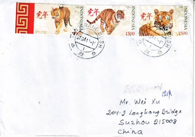
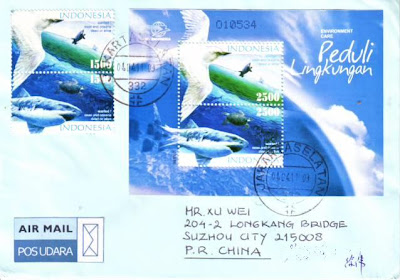
LOST STAMPS on COVER
订阅:
评论 (Atom)


 otherside
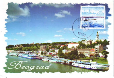
  city of Belgrade

 from Pinang
 this cover from KL


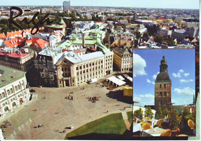
 Riga
Riga
 Thanks


 BRASIL


